Earth Observation Data Access Gateway (3.9.2.dev20+gcca75a8fd)#
![]()


![]()

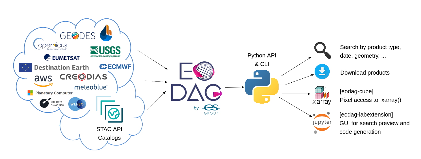
EODAG (Earth Observation Data Access Gateway) is a command line tool and a Python library for searching and downloading remotely sensed images while offering a unified API for data access regardless of the data provider.
Explore EODAG featured providers
EODAG comes already configured with many providers from AWS / GCS EO catalogs, Copernicus, CNES, Destination Earth, ECMWF, ESA, EUMETSAT, Meteoblue, Planetary Computer, USGS / Landsat, …
EODAG has the following primary features:
Search and download Earth Observation products from different providers with a unified API
It is both a Command Line Tool and a Python library
It supports STAC and Static STAC catalogs
New providers can be added with a configuration file or by extending EODAG with plugins
More than 270 product types configured
Example#
Register to one or more providers, configure your credentials , and then downloading Sentinel 2 Level-1C products from any provider’s catalog is as simple as:
from eodag import EODataAccessGateway

dag = EODataAccessGateway()

search_results = dag.search(
    productType="S2_MSI_L1C",
    start="2021-03-01",
    end="2021-03-31",
    geom={"lonmin": 1, "latmin": 43, "lonmax": 2, "latmax": 44}
)

product_paths = dag.download_all(search_results)
Breaking change in v3.0.0
search() method now returns only a single
SearchResult instead of a 2 values tuple.
Or:
eodag search --productType S2_MSI_L1C --box 1 43 2 44 --start 2021-03-01 --end 2021-03-31
eodag download  --search-results search_results.geojson
License#
EODAG is available under the open source Apache License.